Shannon Lake vs BC Hydro Option 2a/2b
Click the headings below to see how this project will impact our community.
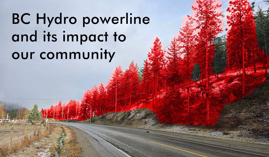
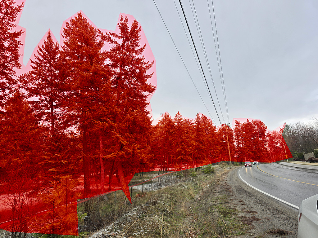
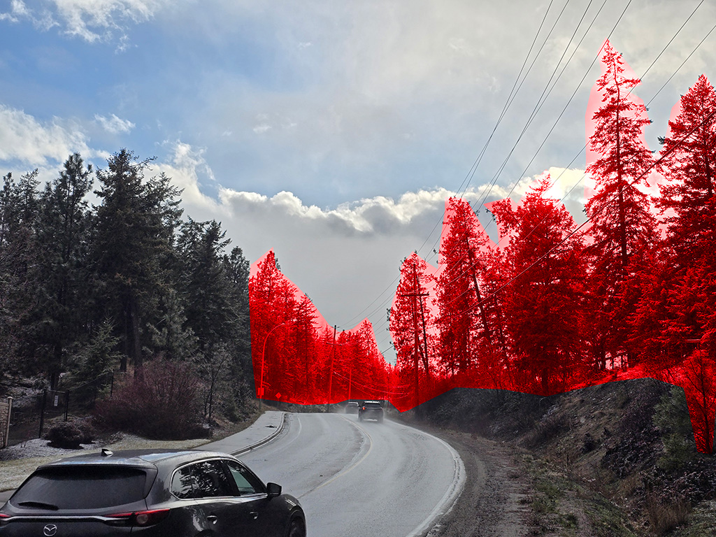
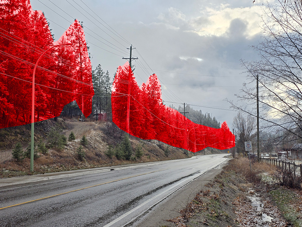
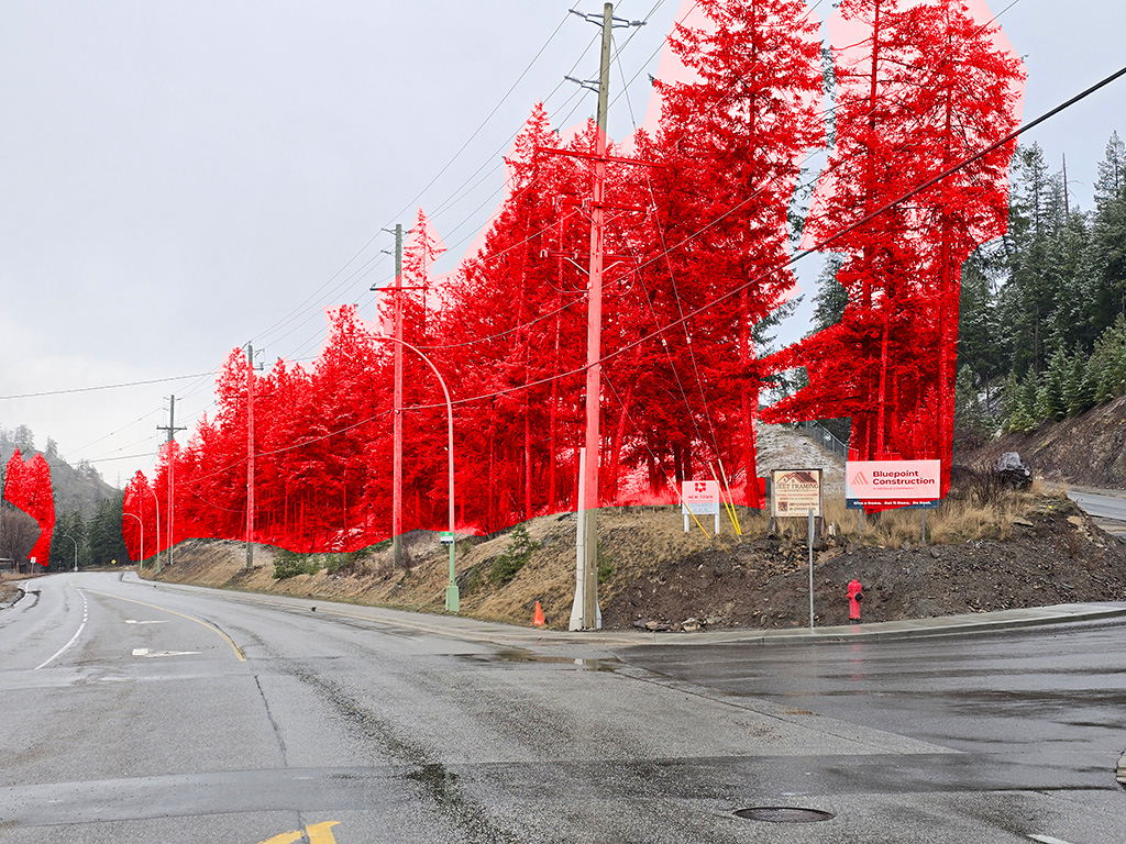
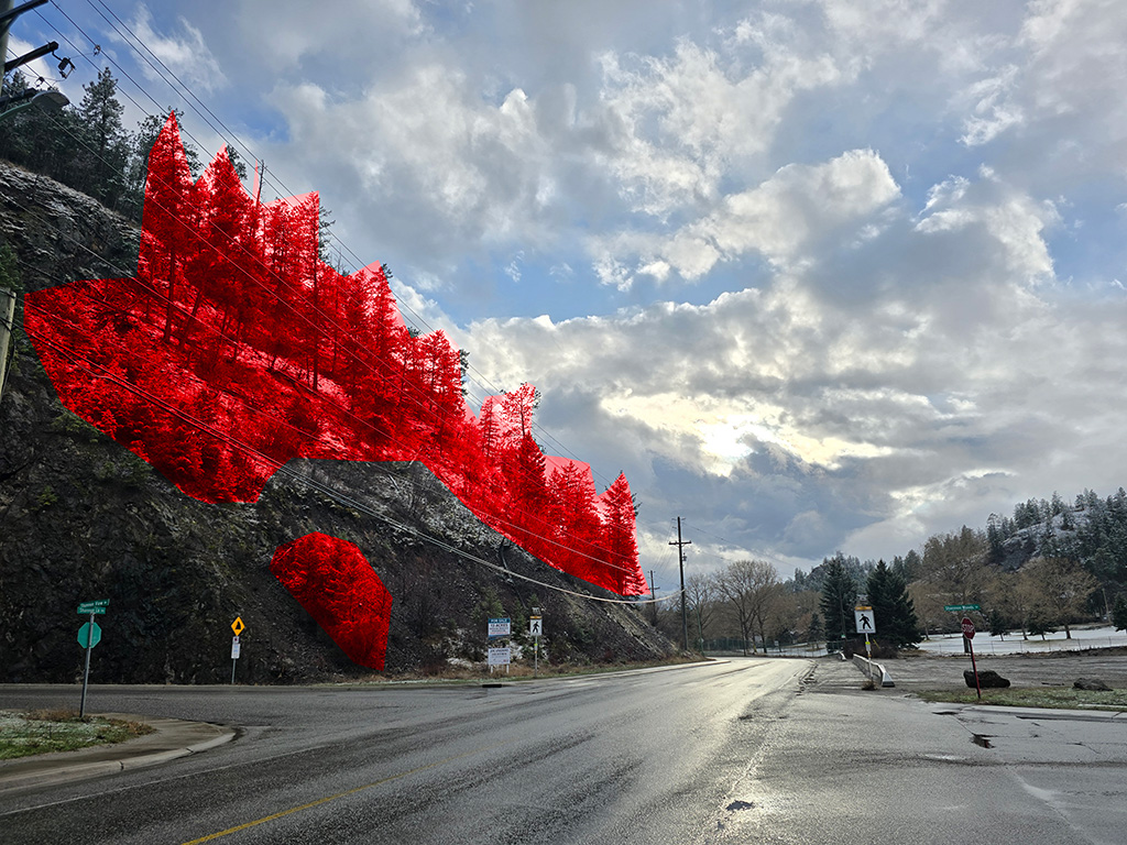
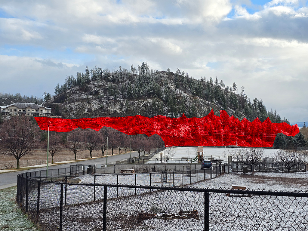
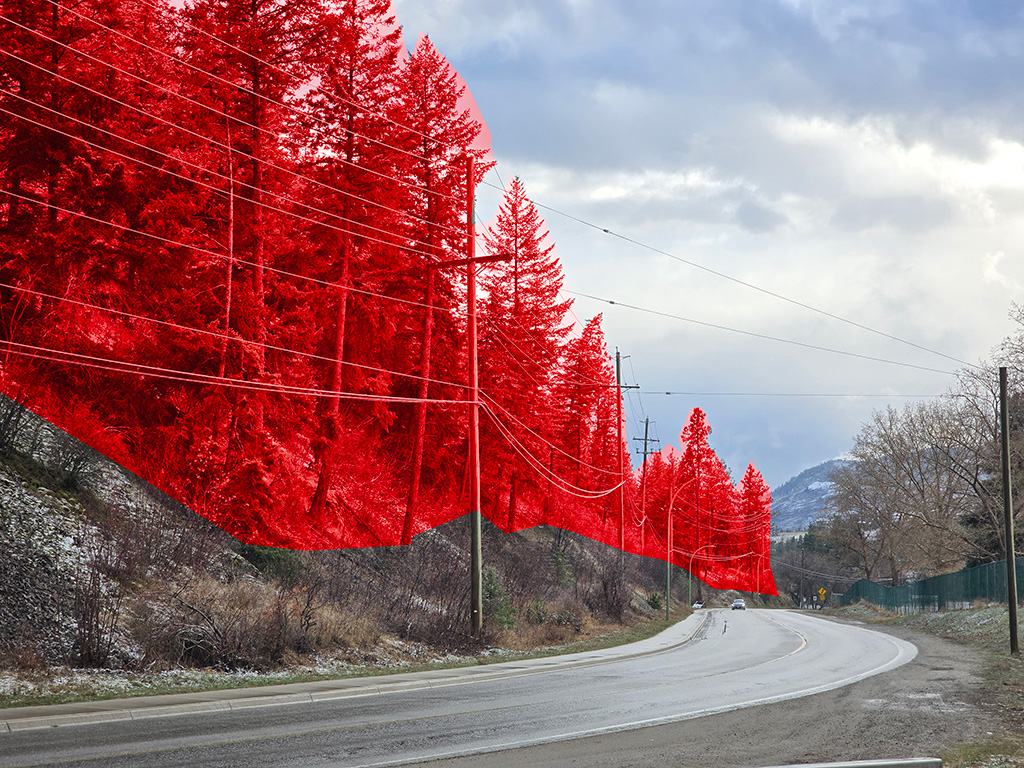
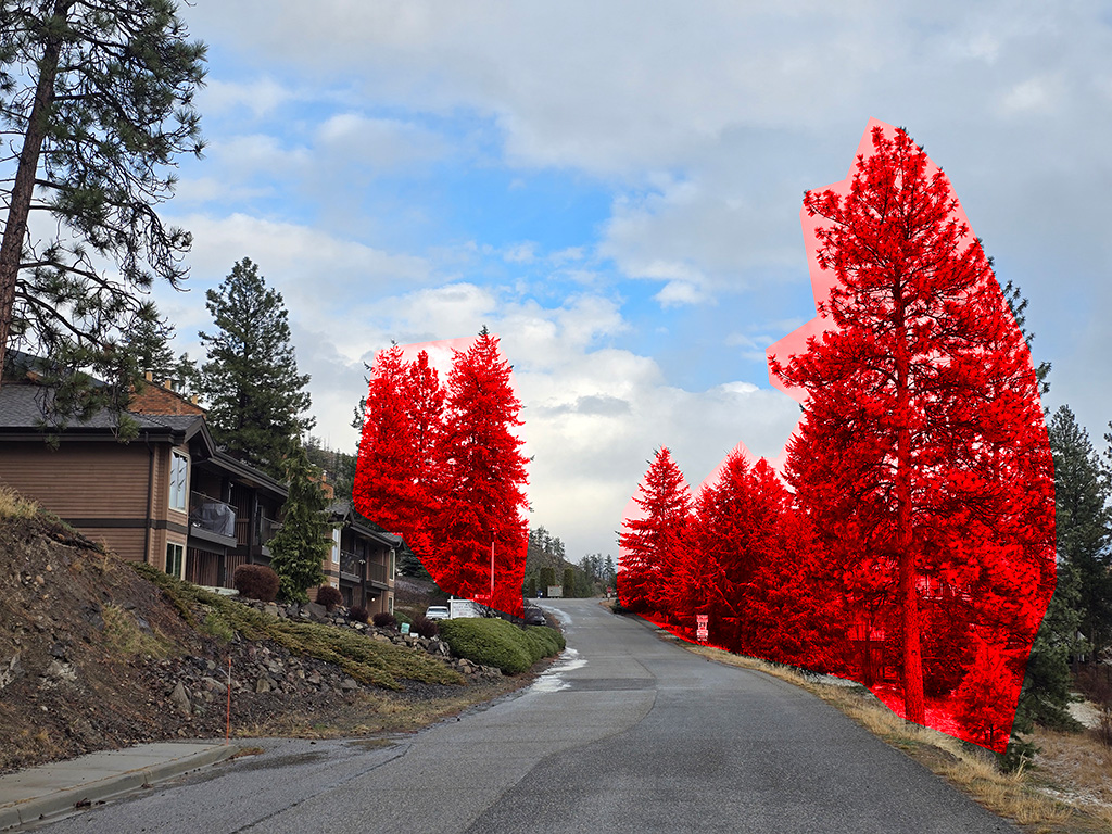
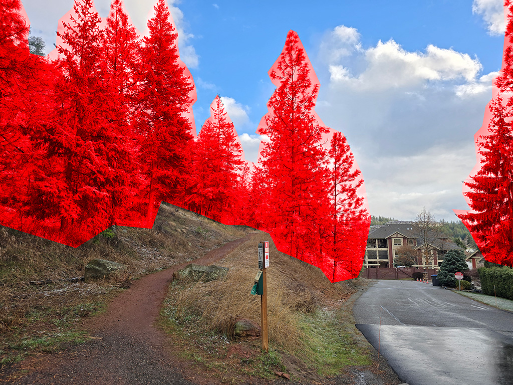
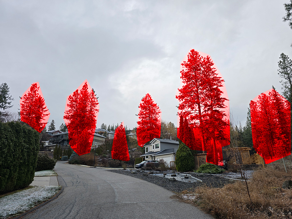
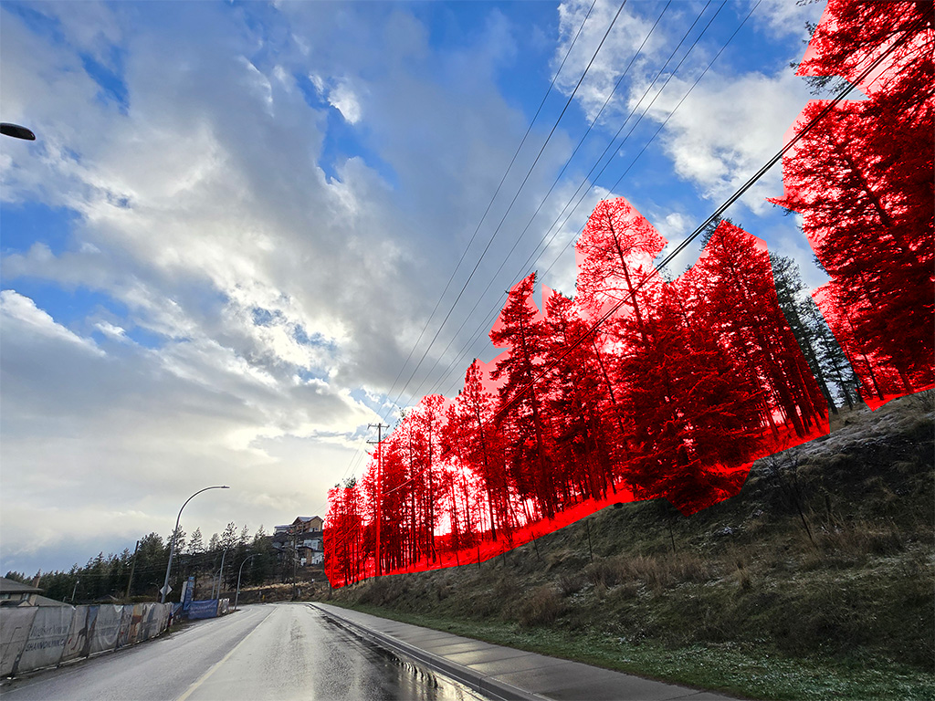
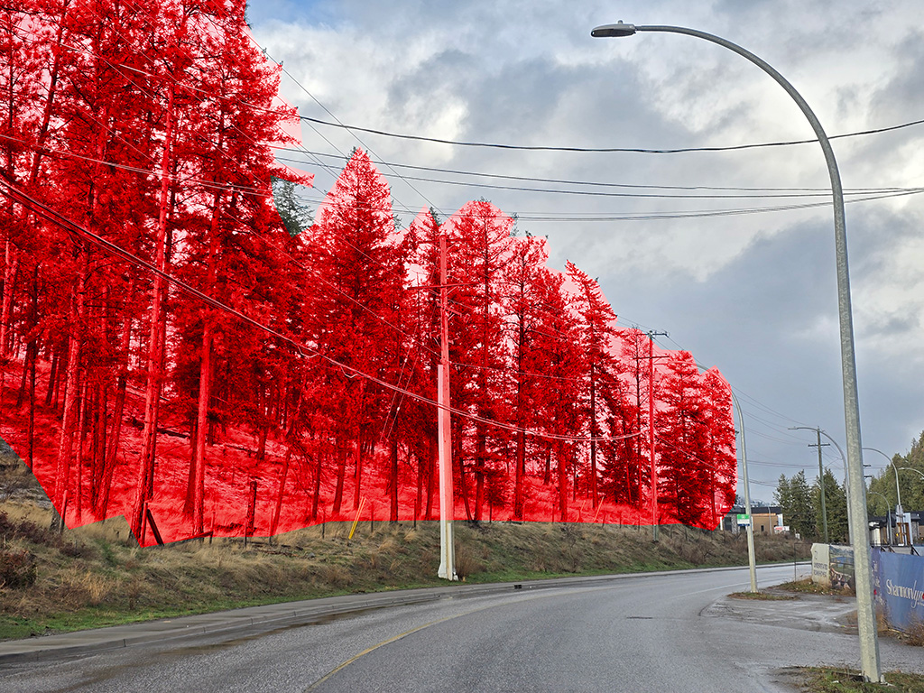
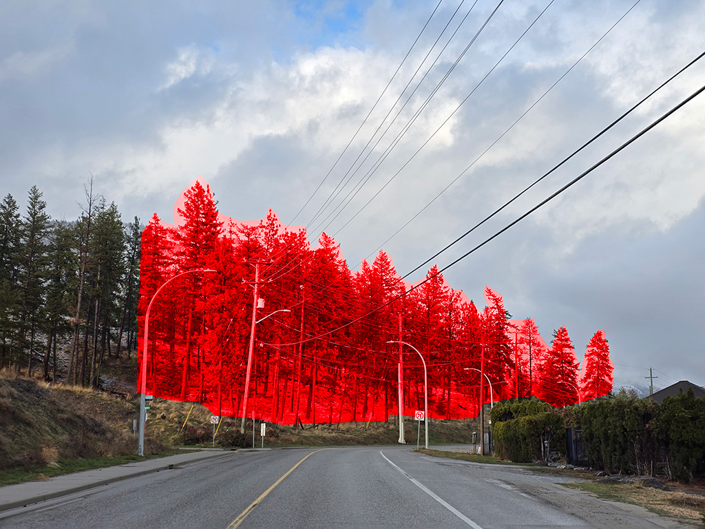
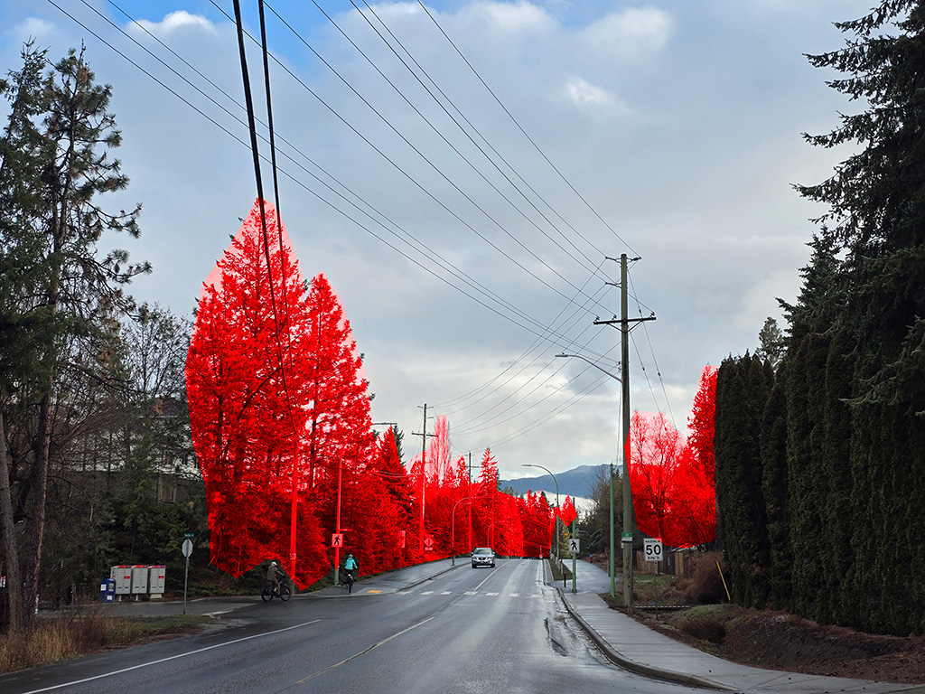
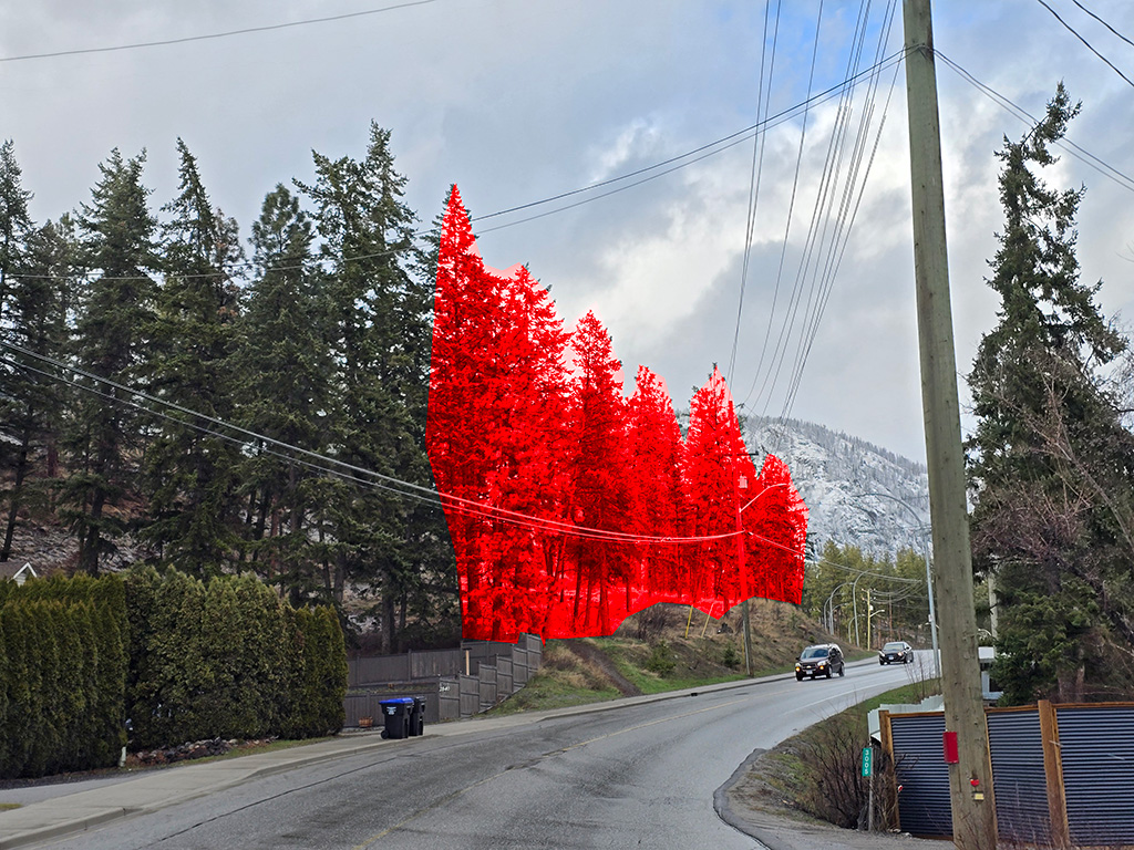
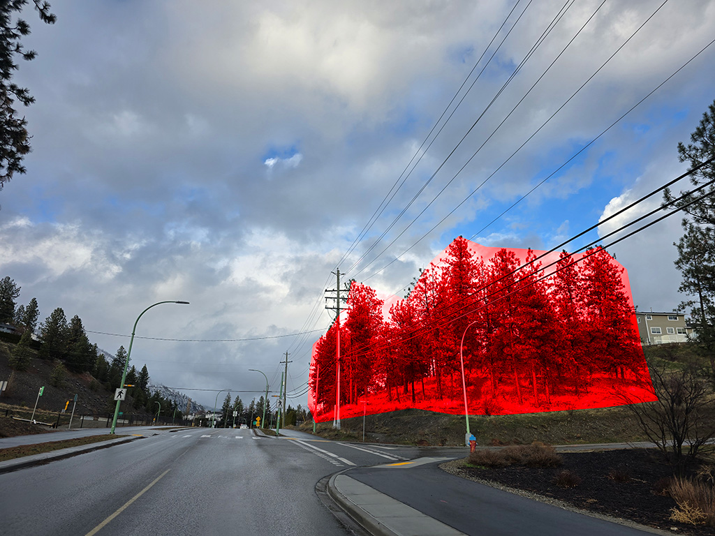
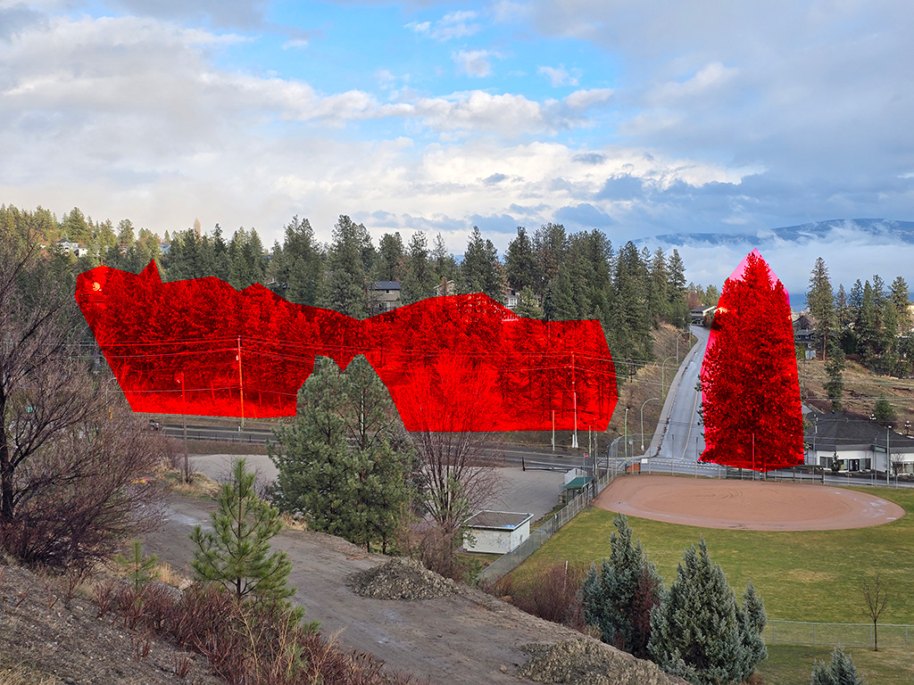
Deforesting Shannon Lake Road
One of the main options BC Hydro is considering will cause significant deforestation along Shannon Lake Road.
Existing Transmission Line Clearance
The clearance along the existing transmission line is around 40m wide. At the measured pole the clearance was 25m on one side, though the exact clearance will vary by location and tree types.
![]()
![]()
New Transmission Line Clearance
The required clearance for the new transmission line has not yet been shared by BC Hydro. The goal of the clearance is to prevent tall trees from falling onto the power lines.
Clearance to the existing distribution power lines is nowehre near as strict.
The following sketch shows the 33m (100ft) power poles mentioned by BC Hydro, with 2.5m spacing between phases, a 3m strict buffer, and a 2m contingency buffer (total buffer of 5m).
Trees of varying heights have been drawn, both standing and fallen over.
Clearances will change based on topography. Trees on an adjacent hill will have to be even farther away from the power lines.
The final requirements will no doubt be properly engineered by BC Hydro and their consulting arborists, however this information must be known before committing to a route, not after.

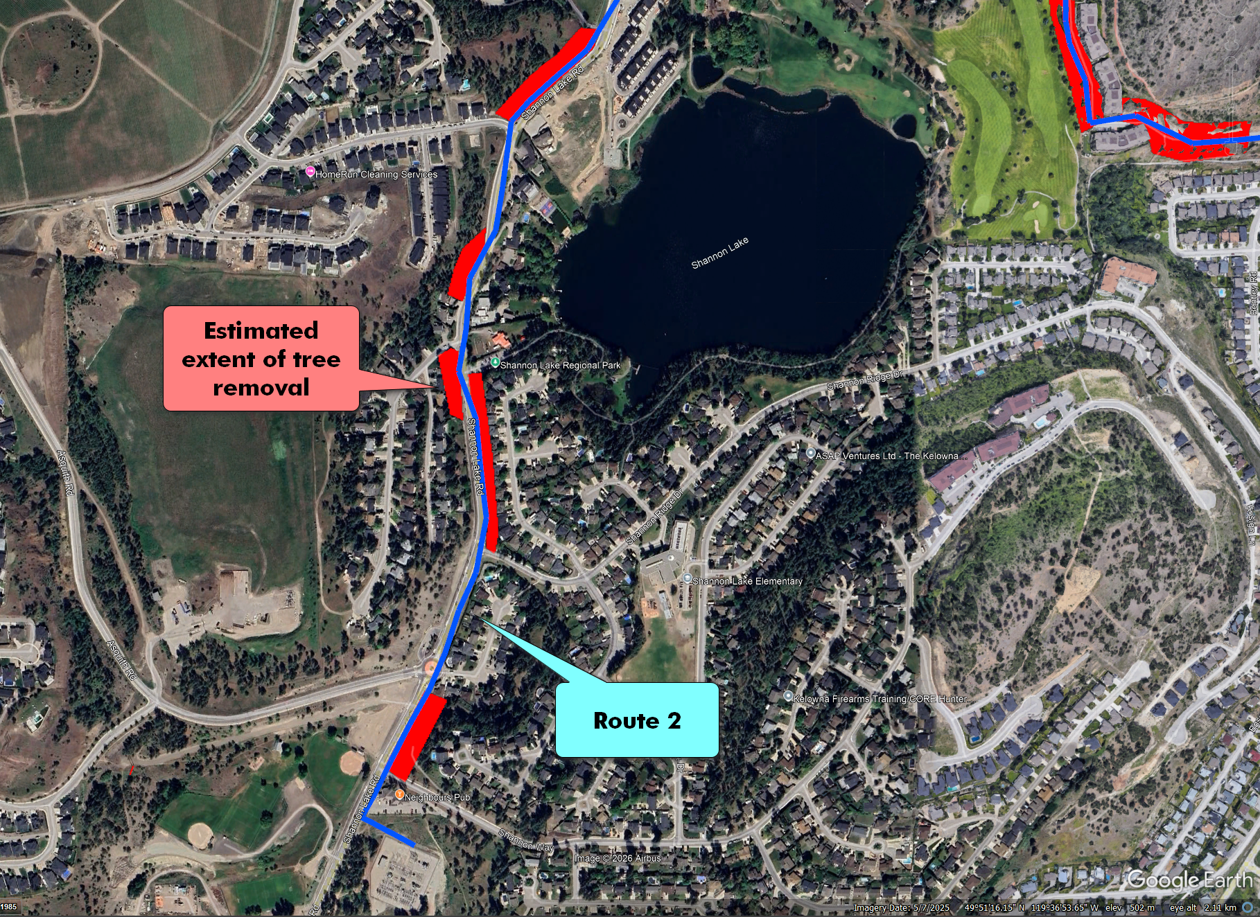
Impact to Shannon Lake Road North
Option 2B impacts the northern stretch of Shannon Lake Rd.
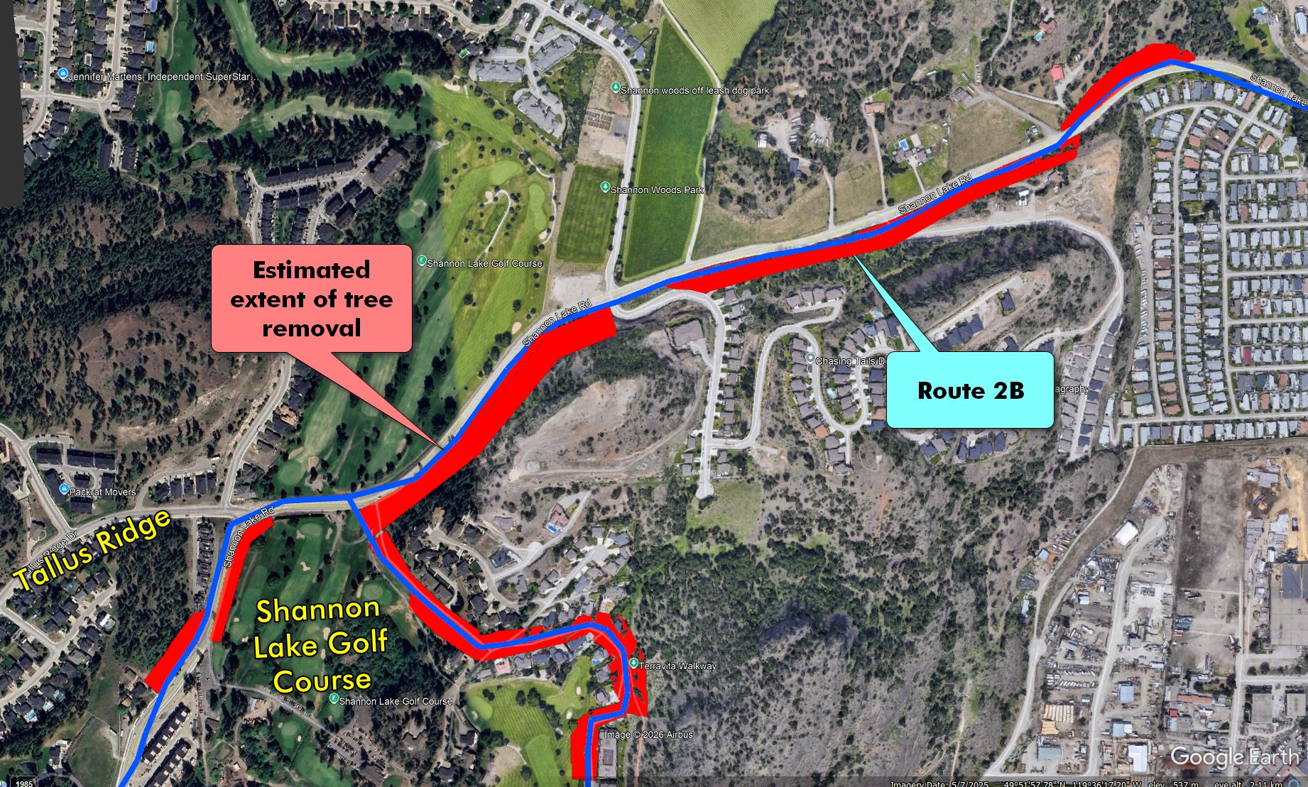

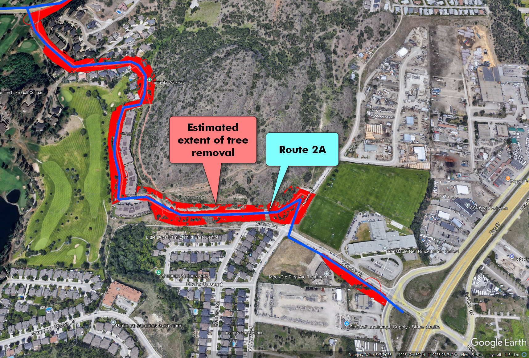
Impact to Shannon Lake Golf Estates
Option 2A impacts the area between Shannon Lake Rd. and CNB school.
Impact to Shannon Lake Road South
Both options 2A and 2B impact the Shannon Lake Rd. from the golf course to the BC Hydro substation.
For your convenience, refer to the Suggested Survey Answers below to help craft your response to BC Hydro. To keep learning more, review the sections below.
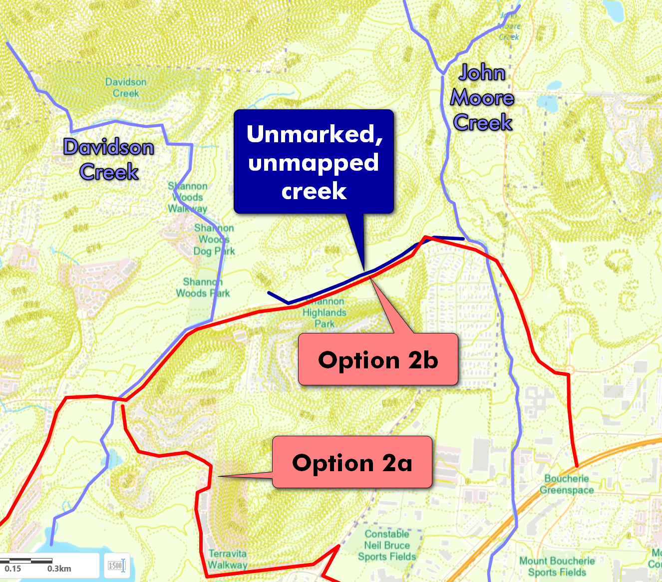
Impact to Creeks
More Creek Impacts than Predicted
In their anaylsis, BC Hydro incorrectly showed Option 2a and 2b as having a reduced impact to creeks. Both options run along established creeks.
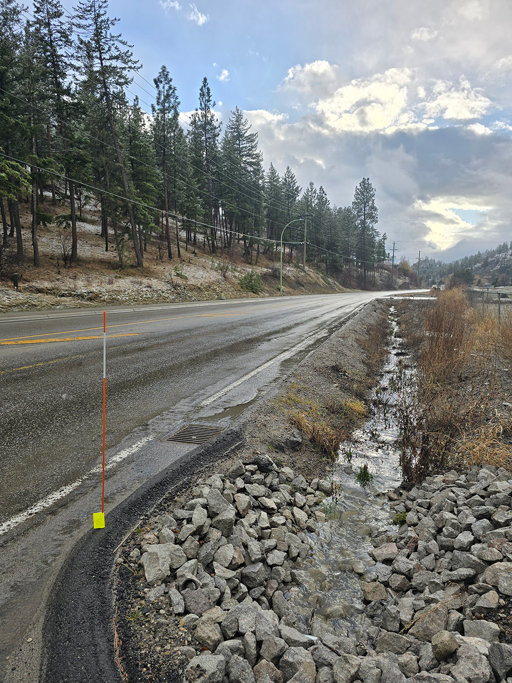
Additionally, it could be that BC Hydro did not include the seasonal creek that runs north from Shannon Woods Dr. to John Moore Creek. This area was subject to flooding in 2024, the City of West Kelowna improved the watercourse with riprap rocks following that event.
The Unmarked Creek
Project Information
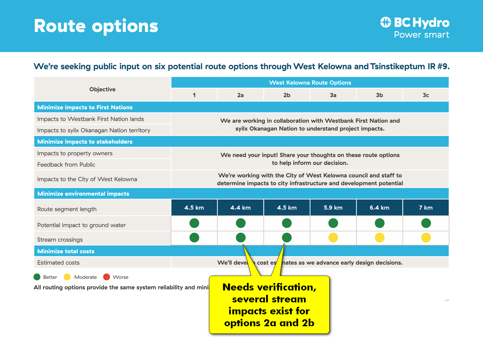
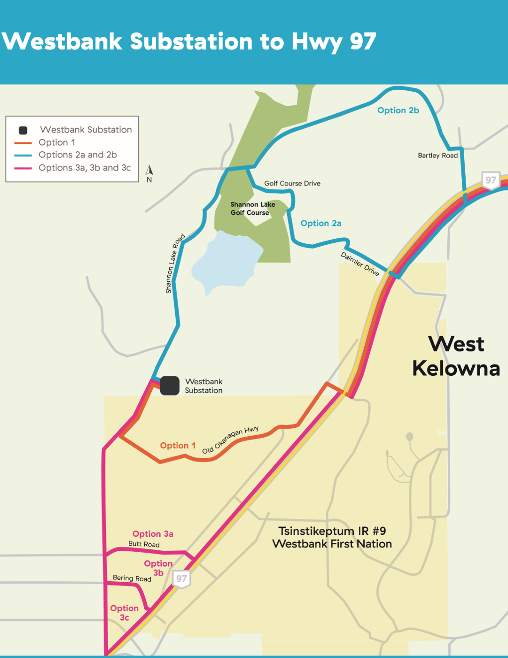
Route Options
The following routes options have been identified by BC Hydro:
BC Hydro Links
Public Comments Timeline
- Comments are due by March 31
- BC Hydro prepares a package of all the comments.
- Comment package will be shared with government stakeholders (including City of West Kelowna).
- BC Hydro and government select the preferred option.
Suggested Survey Answers
We have included some suggestions below to use verbatim or inspire your own response. By all means vote with your own conscience and highlight the points you feel are most important to you.
Question 1: How Clear is the Map
How clear are the six route options shown to you in the above map?
Very Unclear
Please tell us what was unclear in the map.
The routes do not clearly show the impact to forested areas along the route and therefore do not sufficiently communicate the impacts to affected communities.
Question 2: Vote on Routes
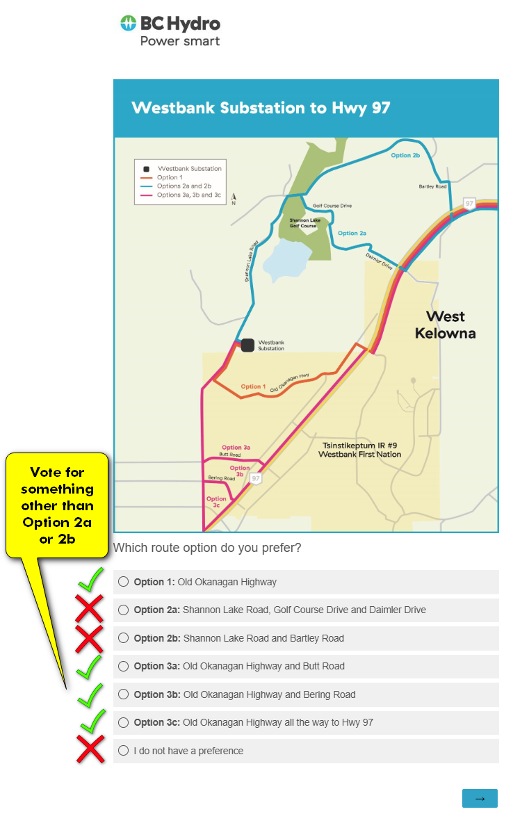
To protect the character of Shannon Lake Rd communities, please vote for something other than Option 2a or 2b.
Question 3: Explain your Vote
Why do you prefer Option _____?
I feel this option minimizes the impact to forested areas and established community character.
Question 4: Do you have any additional comments?
BC Hydro information sheets noted that Option 2 had a reduced impact to rivers and creeks, however it crosses John Moore Creek near Bartley Rd. and also runs along a seasonal creek (not marked on maps or West Kelowna GIS) along the length of Shannon Lake Rd. starting near Shannon Woods Dr. to John Moore Creek. Option 2 also runs along the length of Davidson Creek from Shannon Woods Dr. to Shannon Lake.
For your convenience, refer to the Suggested Survey Answers to help craft your response to BC Hydro.
This site is not affiliated with BC Hydro and has been created by Erik Wiik, a resident in the neighbourhood.
The extent of tree removals is based on the route shared by BC Hydro open house on February 25, 2026, the existing power line route, and a clearance zone of around 20m to 30m on either side of the power lines depending on topography.
This site uses a tracking pixel to determine the number of connections to the site and their location to determine effectiveness of publicity efforts.
Other Contacts
At this time we believe the best course of action is to fill in the BS Hydro survey, since these become part of the official project for feedback for this work. One local representative said the these responses will be collated and shared with all the local elected repsresentatives.
If you're feeling inspired after filling in the BC Hydro survey, go ahead and reach out to representatives directly:
- MLA Macklin McCall+1-250-387-3507[email protected]
- West Kelowna Mayor and Council+1-778-797-2210[email protected]
For further neightbourhood advocacy, you can reach out to SNLA:
- Shannon Lake Neighbourhood Associationhttps://www.shannonlake.org
The contacts above are listed for convenience and are not affiliated with this site.